

Hey everyone! Lauren here! It has been quite a while since we last posted. We got very behind on our blog because we were too busy enjoying our trip, and when we got back to our home in Ohio, USA, we never caught up. Hopefully it is not too late to share our incredible experience, and don't worry, we kept a very detailed journal.
And so, now to talk about the two amazing hikes we did near Wanaka on the South Island of New Zealand!
Driving from Franz Josef to Wanaka
After eating breakfast in our hostel in Franz Josef, we packed up our things into our trusty rental vehicle and began our 4 hour drive to Wanaka! About 2 hours into our drive, we decided to stop at Knight's Point Lookout to use the bathroom and take pictures of the beautiful view of the coast before continuing our drive further inland through the mountains.

As we continued our drive, we were on the lookout for the mountains that were used in the beacon lighting scene in the Return of the King movie. We came upon a valley looking up at snow capped mountains, and determined they kind of looked like the right mountains. We snapped a few pics and kept driving around the beautiful Lake Wanaka.


As we approached Wanaka, we realized the entire town was packed with cars, bikes, and people and it didn't seem like there was any parking. After a quick Google search, we realized there was a large triathlon in a few days called Challenge Wanaka. It became clear why we had trouble finding accommodations in Wanaka, and we were both glad we ended up with an Airbnb about 15 minutes south of town. After stopping by New World to do some grocery shopping, we headed out of Wanaka to our Airbnb to relax for the evening.
Hiking to the Rob Roy Glacier
The next day, we woke up around 8 AM and ate some breakfast, got ready for a day of hiking, and headed out to the Wanaka Visitor's Center. I knew I really wanted to hike the Rob Roy Track, but all the information indicated there were some pretty serious river crossings on the road. Gerrod and I were both unsure if our little rental car could make the crossings. We originally decided to Hike Roys Peak instead, but when we arrived at the trailhead, the parking lot was overflowing and there was nowhere to park, so we decided to risk the river crossings and we continued on to Rob Roy Glacier.
When we came to the river crossing, there was a sign indicating the crossing was only really bad when there has been recent rain. Fortunately, there hadn't been much rain so we made the crossing and headed to the trail head.


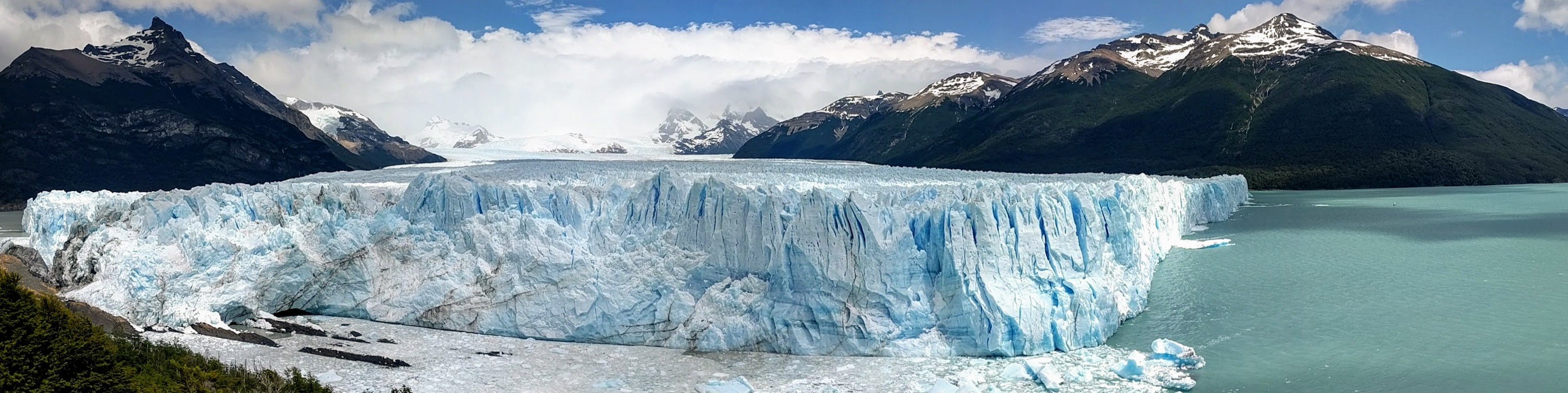
The valley at the start of the hike was gorgeous, and it only took about an hour and a half to get to the Rob Roy Glacier. There were signs along the trail saying that there were frequent sightings of kea in the area, and to not disturb them. I really wanted to see a kea, a very intelligent and very endangered mountain parrot. We were not lucky enough to see any kea, but at least we had some gorgeous mountain views.


After making it to the glacier, we enjoyed some lunch and took some pictures. The glacier is STUNNING. There are several small waterfalls cascading down the cliff, and the green moss and vegetation on the mountains beneath the glacier were such an incredible contrast. There were also some informational signs near the top, and as a chronic informational sign reader, I of course read every single one.


We then made our way back down the mountain, and then headed back to our Airbnb to make dinner, do some much needed laundry, and prepare for our hike the next day!
Hiking Roys Peak
The next day, we woke up bright and early to try and beat the rush to the popular Roys Peak hike. Despite waking up at 7 AM and leaving right after eating breakfast, when we arrived at the Roys Peak parking area around 8 AM, there were no available spots! Luckily, soon after we arrived, we saw a guy finishing the hike. He seemed to be getting ready to leave, so we waited for him to vacate the parking spot. While we waited, Gerrod and I realized this guy must have started hiking at 3 or 4 AM to complete the hike that early! We must not be dedicated hikers, because I don't think I could do that.

The trail was so steep, and there was absolutely no shade along the trail. It was a very sunny day out, and needless to say I was STRUGGLING. It took us about 3 hours to get to the top. The 360 degree view was definitely worth the struggle! We had a bird's eye view of the entire town of Wanaka nestled between the mountains, and could see the vast Lake Wanaka. We ate some lunch, took some pictures, and appreciated the view before heading back down the mountain.


On our way back down, I made Gerrod stop at some very popular photo spots to take some cute photos together. We even waited in a line for one, and honestly it wasn't worth it. It took less time to get back to our car, and after about 2-2.5 hours, we were packing up our gear and headed back to our Airbnb to make some dinner and enjoy some wine we got from the grocery store.


The Wanaka Tree
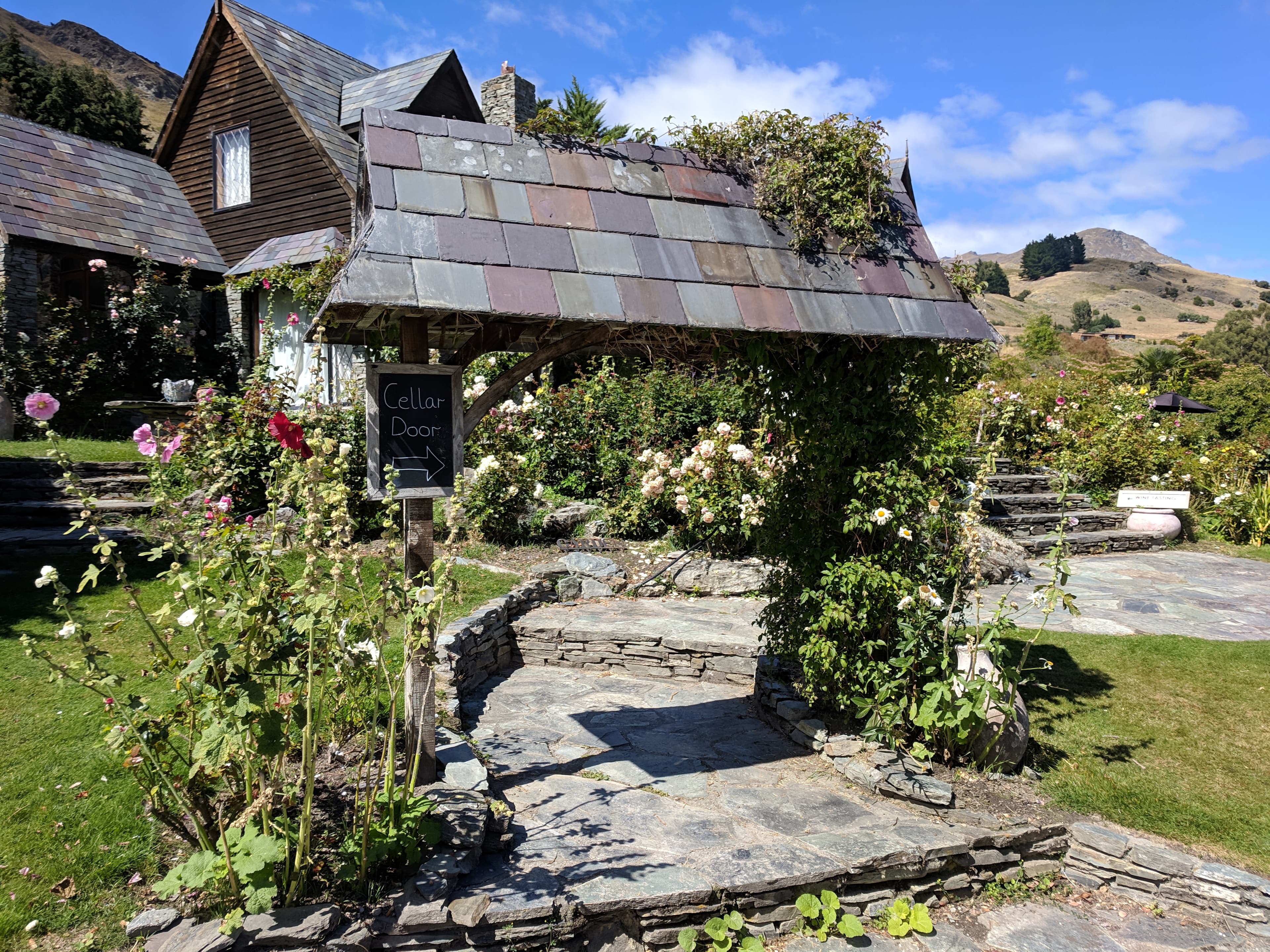
The next day, we visited some wineries and stopped at the famous #ThatWanakaTree. You can find it just outside of town, and it is definitely worth a quick stop even though it is an "Instagram" popular spot. The tree looks so out of place in the water, and as an added bonus there was a momma duck and two babies swimming near it. I am going to make a separate post about the wineries we visited in the Otago Wine Region, which includes those around Wanaka, so keep an eye out for that post next!


Until next time!
Lauren (and Gerrod)